For each case study a quick description of ground effects and possible
damages is reported including a link to the reports of Civil
Protection authorities (if available).
The skills for precipitation scenarios prediction and
flood alert indeces for each algorithm are also given with the following
acronyms:
- Stress Area Localization (C-SAL) and
Timing of event (C-SAT) with CAI algorithm
- Stress Area Localization (B-SAL) and Timing of event
(B-SAT) with BBD algorithm
For case studies in which no damages or floods are observed we only give
an indication if a false alarm is given by different indeces.
Below the figures a detailed comment about the peculiarities of the case study
is reported.
In this link, we reported how the
Indices
are calculated.
|
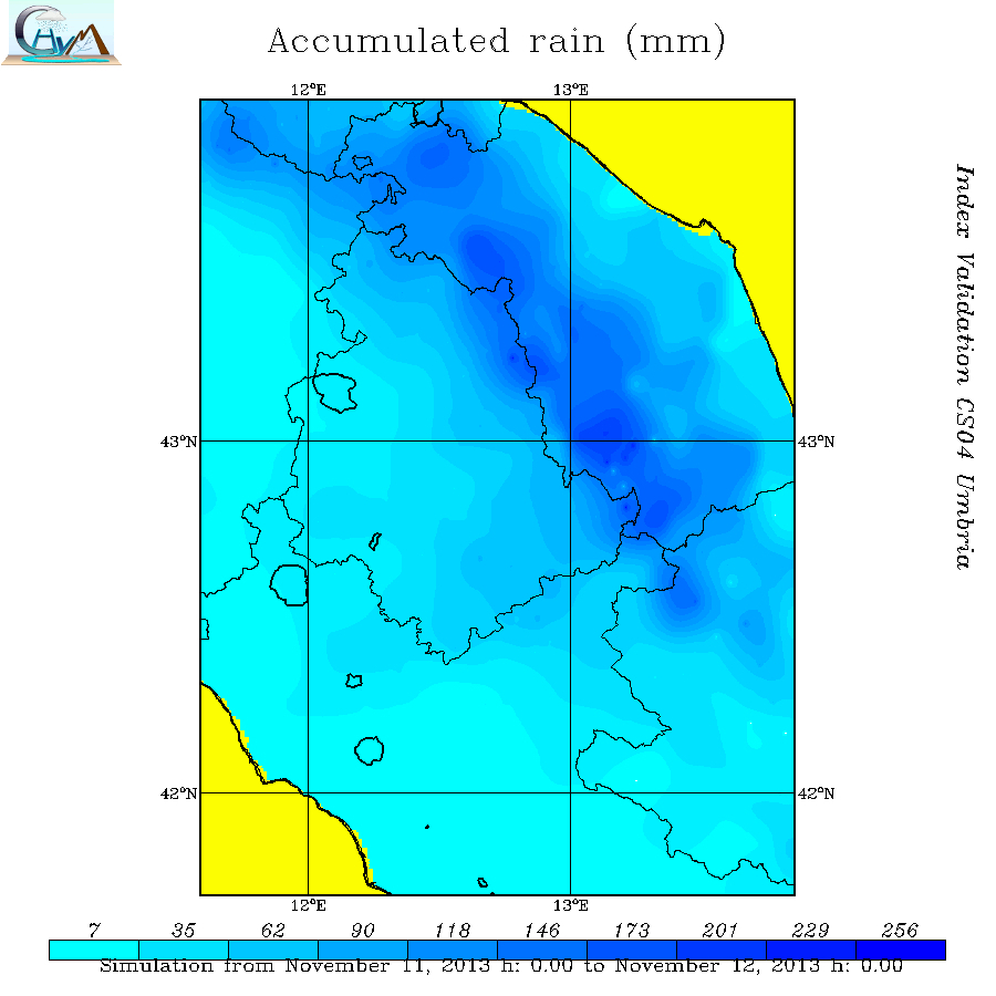
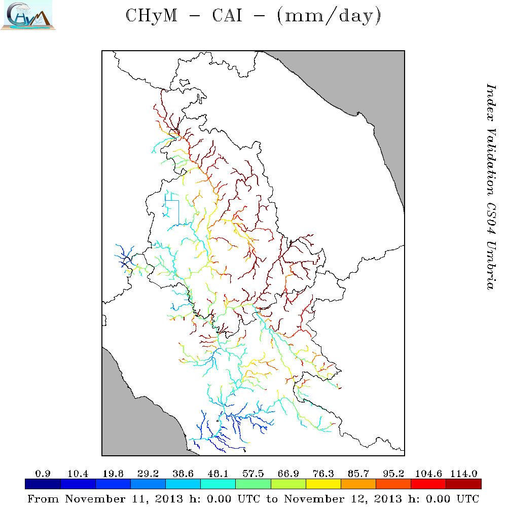
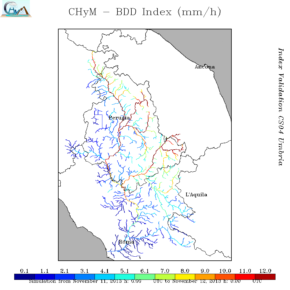
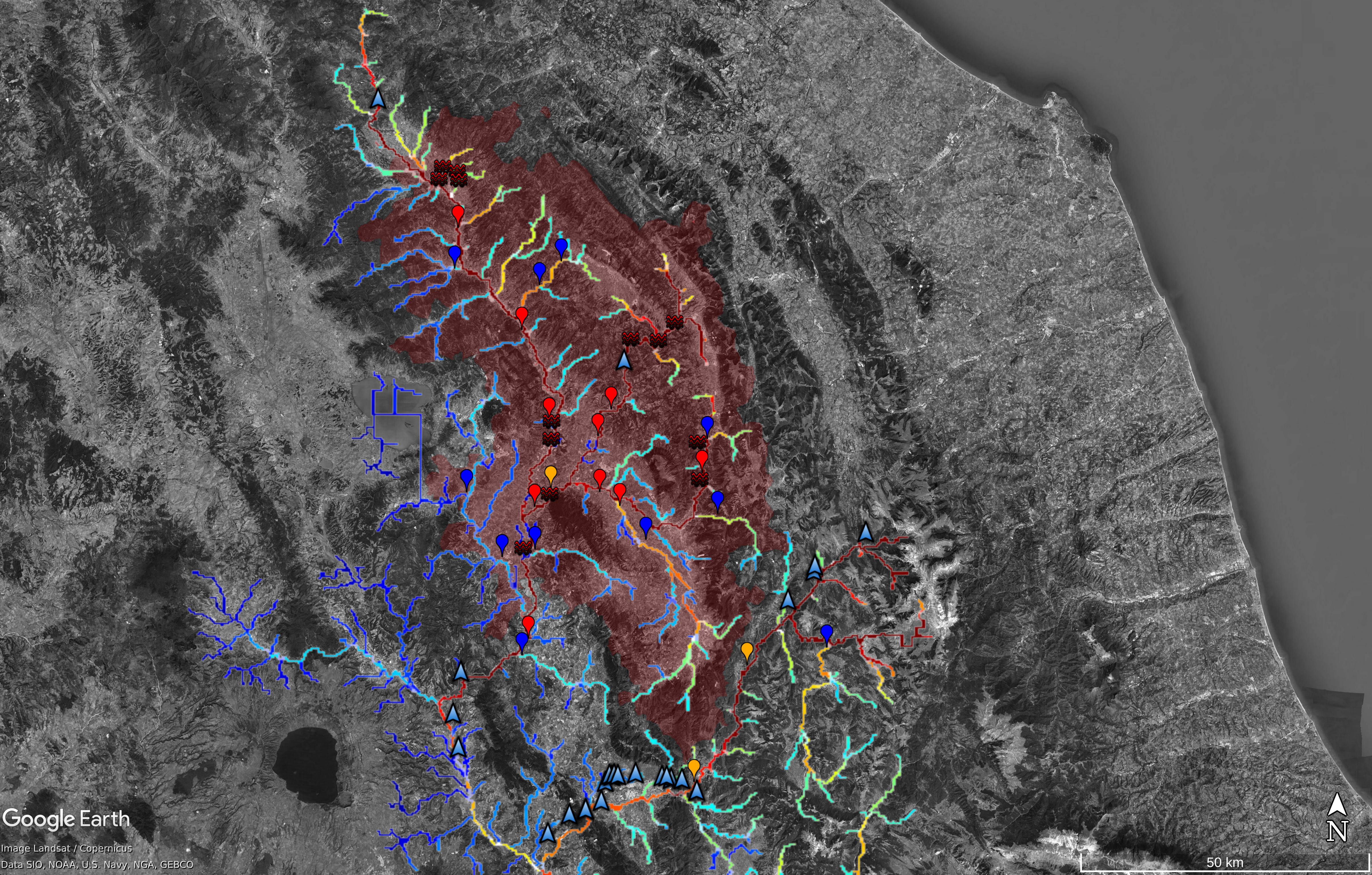
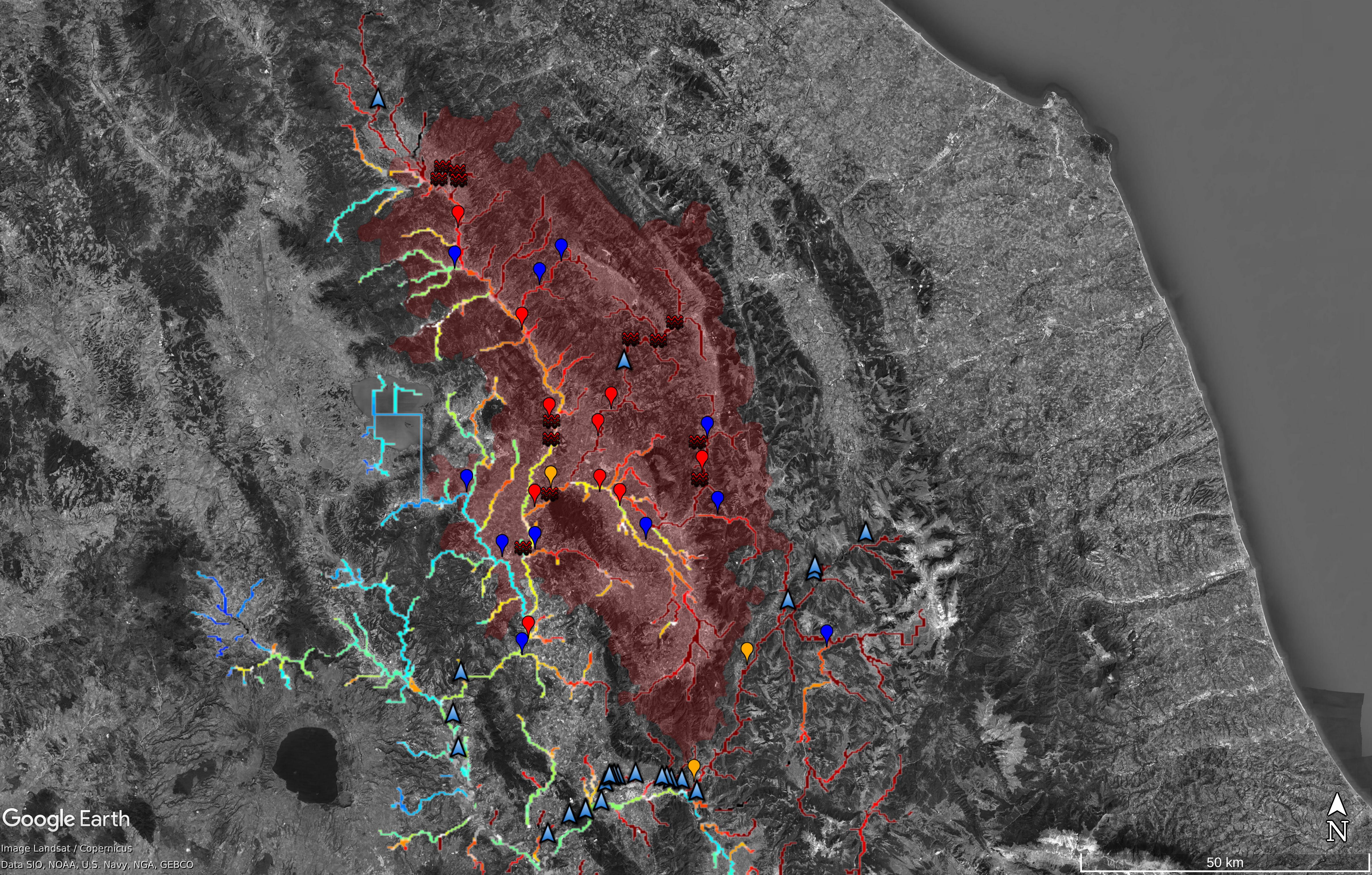
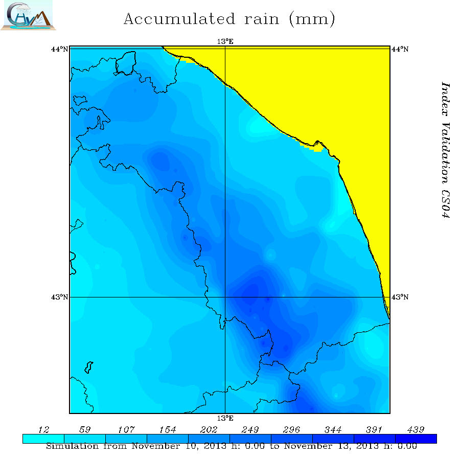
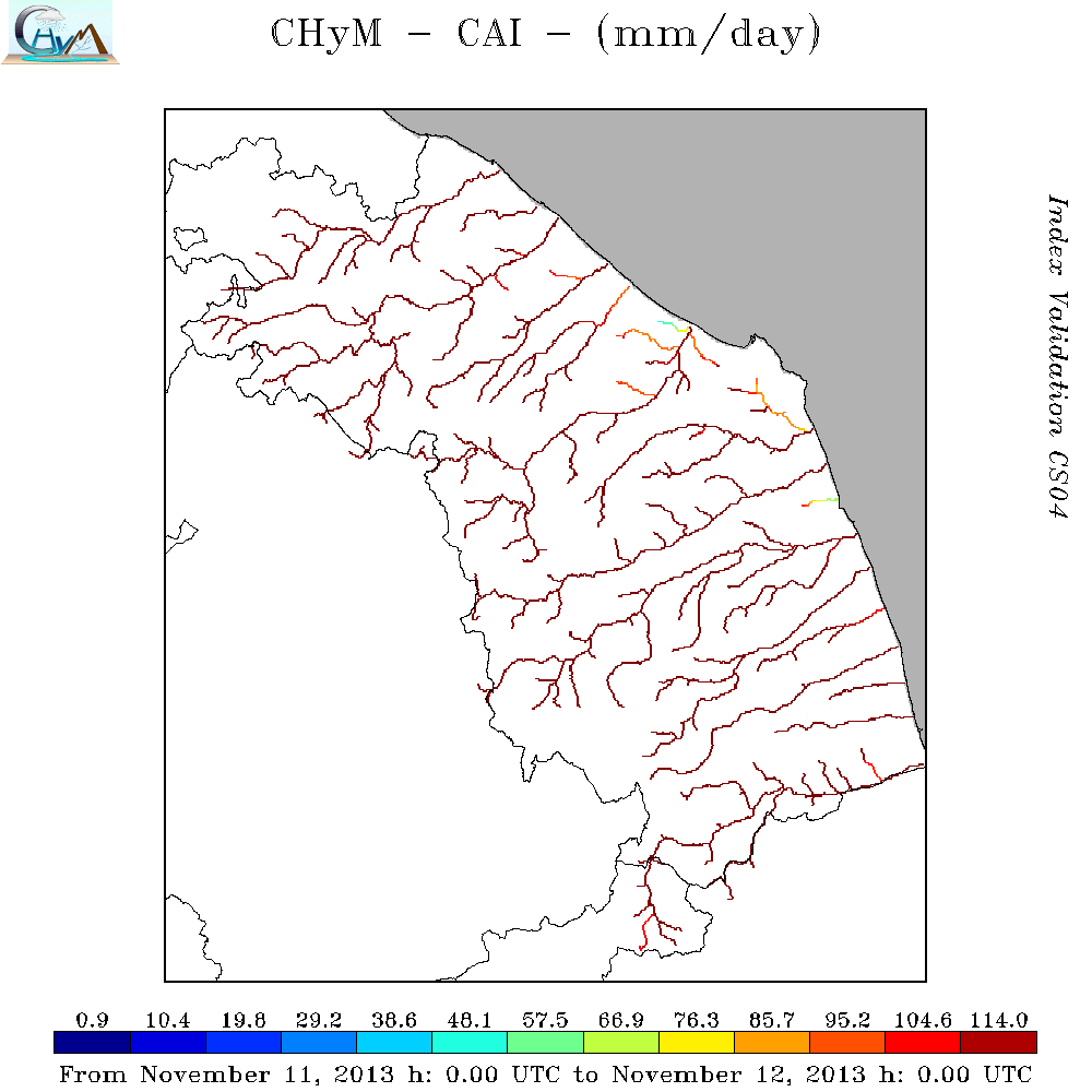
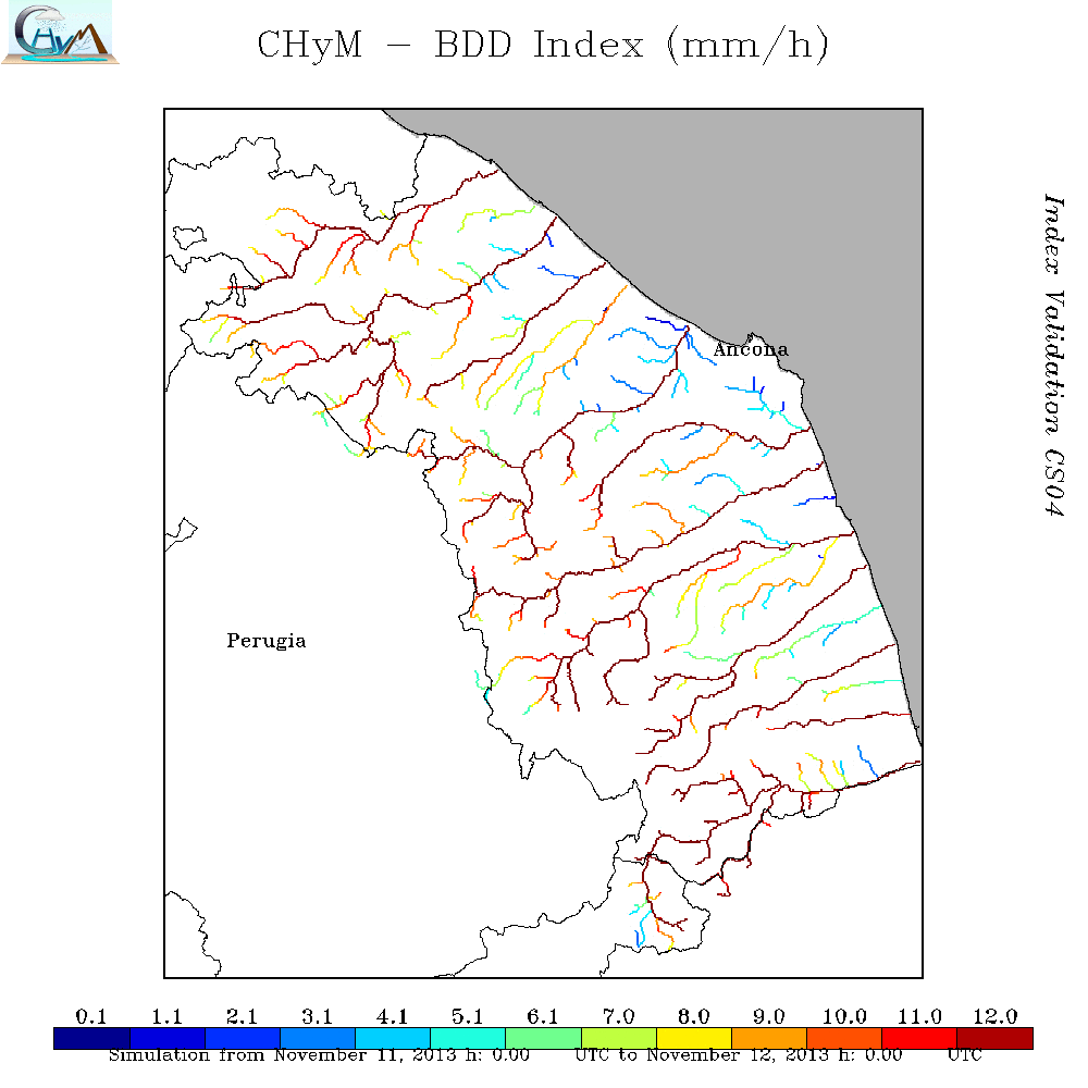
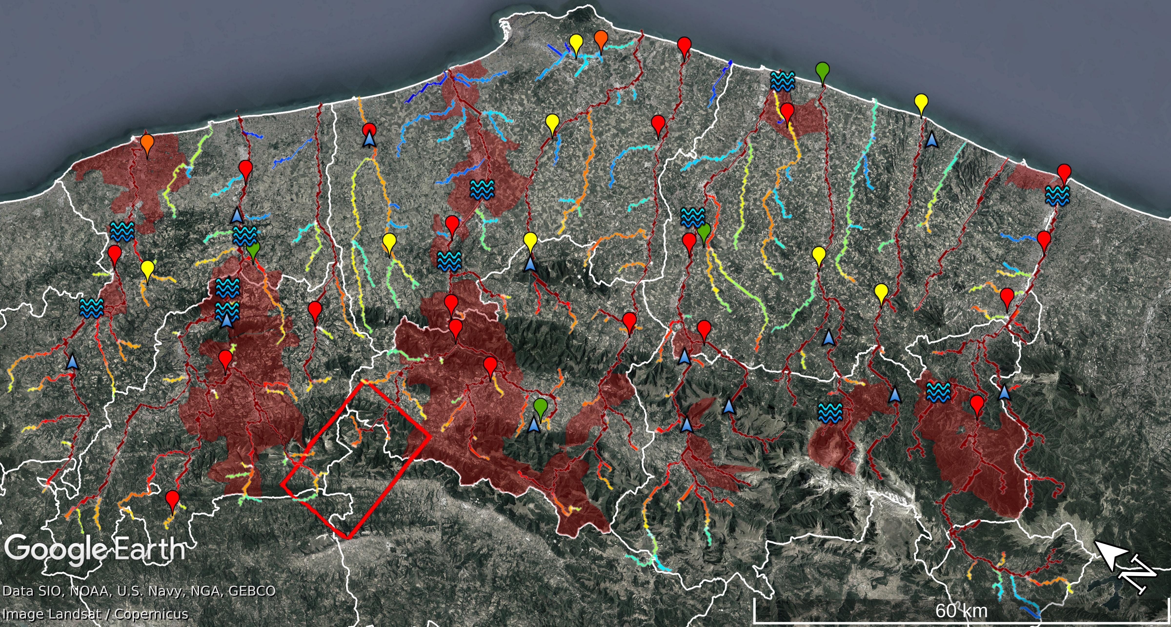
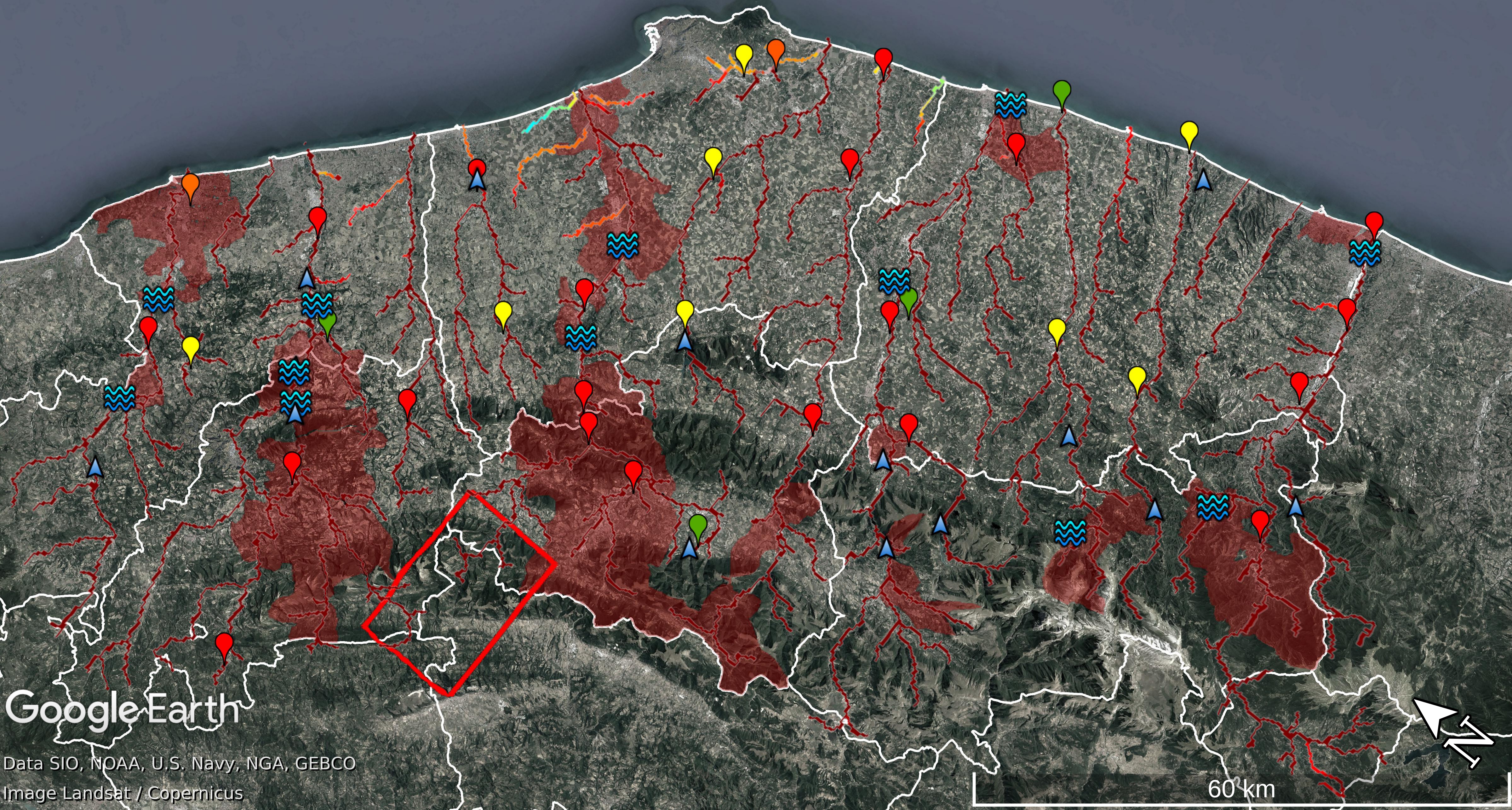
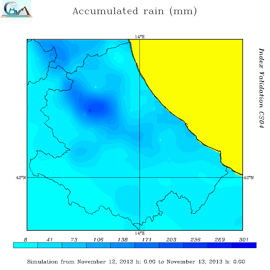
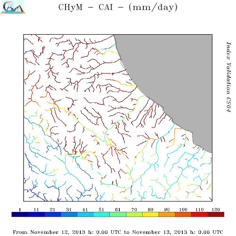
CS01 - Umbria 11st-12nd November 2013 - Tevere, Chiascio and Topino Floods
|
Heavy rainfall began late on Sunday, 10th November and caused severe
floods and landslides across the western side of the
Umbria Region and the eastern side of Umbria Region.
|
|
| Case Study |
OBS
24h Cumulated
Rain Map |
CAI Map |
BDD Map |
BDD SOMMARIZED EVENT Map |
CAI SOMMARIZED EVENT Map |
| Nr |
01 |
| Area |
Umbria Region |
| Date |
11st-12nd November 2013 |
|
|
|
|
|
|
| Comparison prediction/observation and available documentation |
 DOC0101
Case Study Analysis
DOC0101
Case Study Analysis
DOC0102
CAI animation
DOC0103
BDD animation
DOC0104
CS04_umbria.kmz
 DOC0105
COPERNICUS Emergency Management Service
DOC0105
COPERNICUS Emergency Management Service
DOC0106
Umbria CFD Report
DOC0107
Civil Protection Press Review 11st November 2013
DOC0108
Civil Protection Press Review 12nd November 2013
DOC0109
Civil Protection Press Review 13th November 2013
|
|
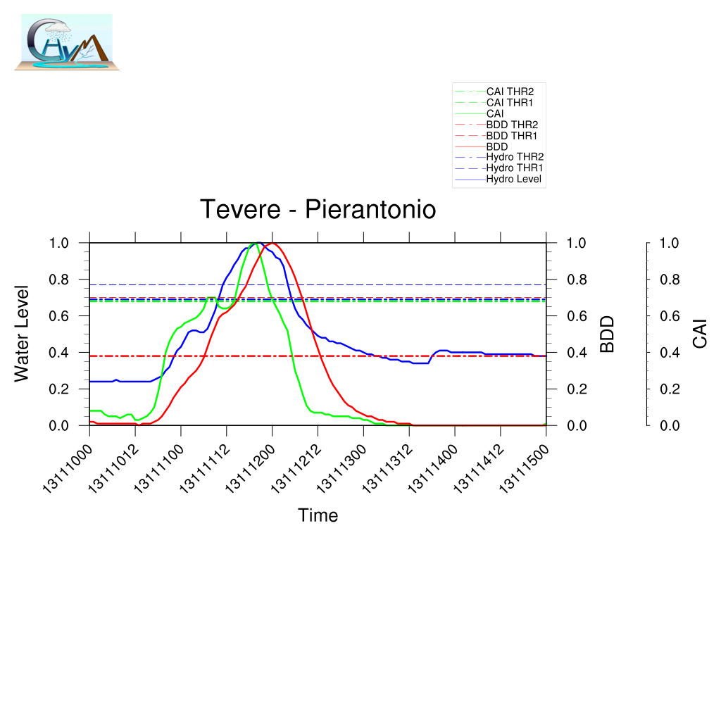
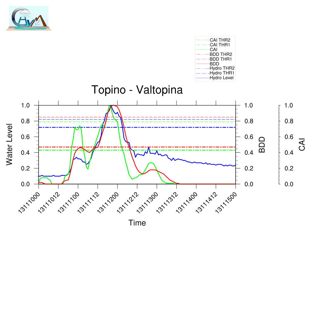
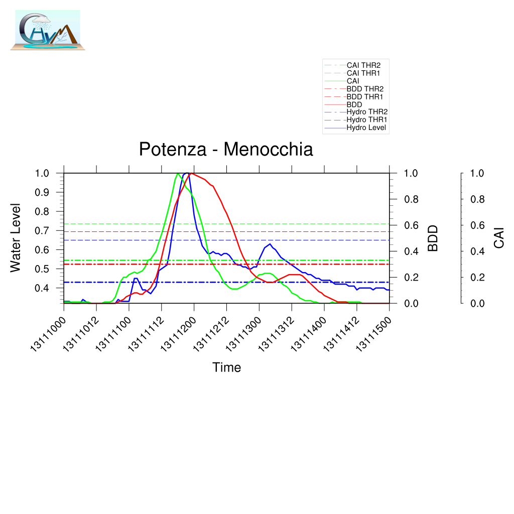
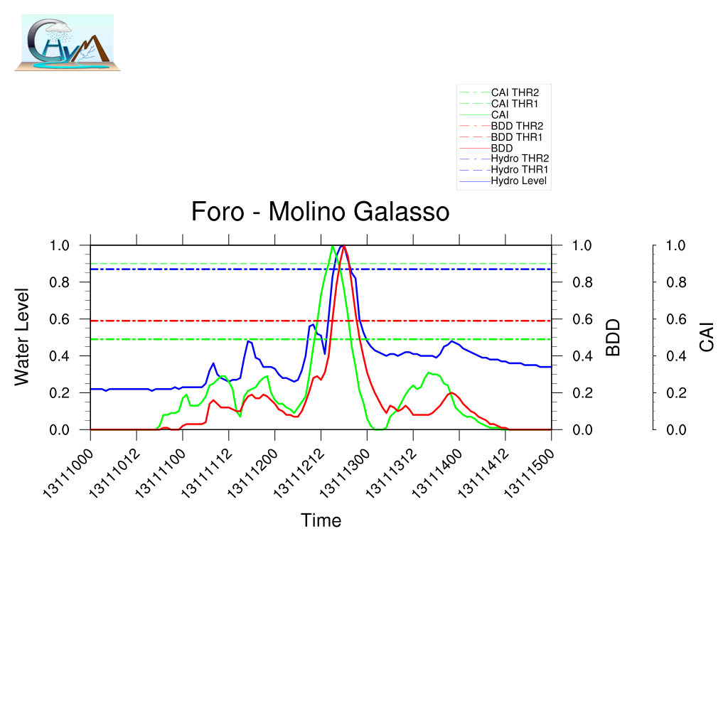
| Example of comparison between predicted/observed time series.
Here the complete analysis |
Summary of BDD performances |
|
|
| Localization |
Timing |
| A | 0.88 | LTP | -0.58 |
| POD | 0.69 | TPI | -0.04 |
| FAR | 0.49 | TMI | -1.25 |
| | DDTV | 0.02 |
|
|
CS02 - Marche 11st-12nd November 2013 - Foglia, Misa and Esino Floods
|
Heavy rainfall began late on Sunday, 10th November and caused severe
floods and landslides across the western side of the
Marche Region and the eastern side of Umbria Region.
|
|
| Case Study |
OBS
Cumulated
Rain Map |
CAI Map |
BDD Map |
BDD Sommarized event Map |
CAI Sommarized event Map |
| Nr |
02 |
| Area |
Marche Region |
| Date |
11st November 2013 |
|
|
|
|
|
|
| Comparison prediction/observation and available documentation |
DOC0201
Case Study Analysis
DOC0202
CAI animation
DOC0203
BDD animation
DOC0204
CS04_Marche.kmz
DOC0205
Marche Region Report
DOC0206
Civil Protection Press Review 11th November 2013
DOC0207
Civil Protection Press Review 12th November 2013
DOC0208
Civil Protection Press Review 13th November 2013
DOC0209
POLARIS - IRPI - CNR
|
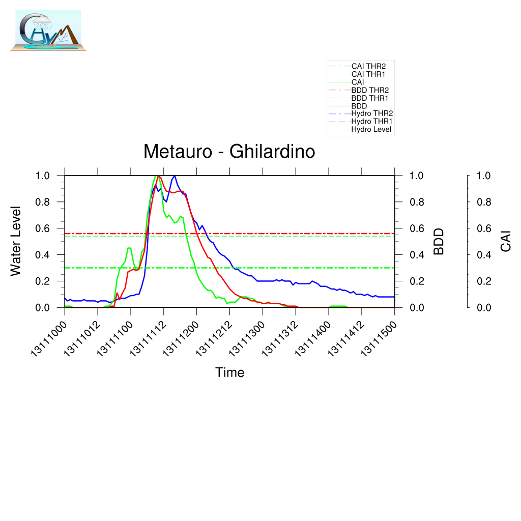
| Example of comparison between predicted/observed time series.
Here the complete analysis
| Summary of BDD performances |
|
|
| Localization |
Timing |
| A | 0.85 | LTP | 0.43 |
| POD | 0.69 | TPI | 0.04 |
| FAR | 0.57 | TMI | -1.4 |
| | DDTV | 0.04 |
|
|
|
CS03 - Abruzzo 11st-12nd November 2013 - Pescara, Vomano and Tordino Floods
|
Heavy rainfall began late on Sunday, 10th November and caused severe
floods and landslides across the North-Estern side of the
Abruzzo Region.
|
|
| Case Study |
OBS
Cumulated
Rain Map |
CAI Map |
BDD Map |
BDD SOMMARIZED EVENT Map |
CAI SOMMARIZED EVENT Map |
| Nr |
03 |
| Area |
Abruzzo Region |
| Date |
12nd November 2013 |
|
|
|
|
|
|
| Comparison prediction/observation and available documentation |
DOC0301
Case Study Analysis
DOC0302
CAI animation
DOC0303
BDD animation
DOC0304
CS04_abruzzo.kmz
DOC0305
Civil Protection Press Review 11st November 2013
DOC0306
Civil Protection Press Review 12nd November 2013
DOC0307
Civil Protection Press Review 13th November 2013
|
| Example of comparison between predicted/observed time series.
Here the complete analysis
|
Summary of BDD performances |
|
|
| Localization |
Timing |
| A | 0.91 | LTP | -8.06 |
| POD | 0.81 | TPI | -1.03 |
| FAR | 0.55 | TMI | -3.58 |
| | DDTV | 0.09 |
|
|
|
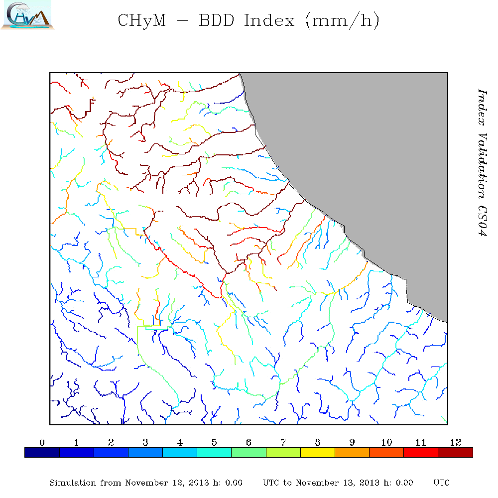
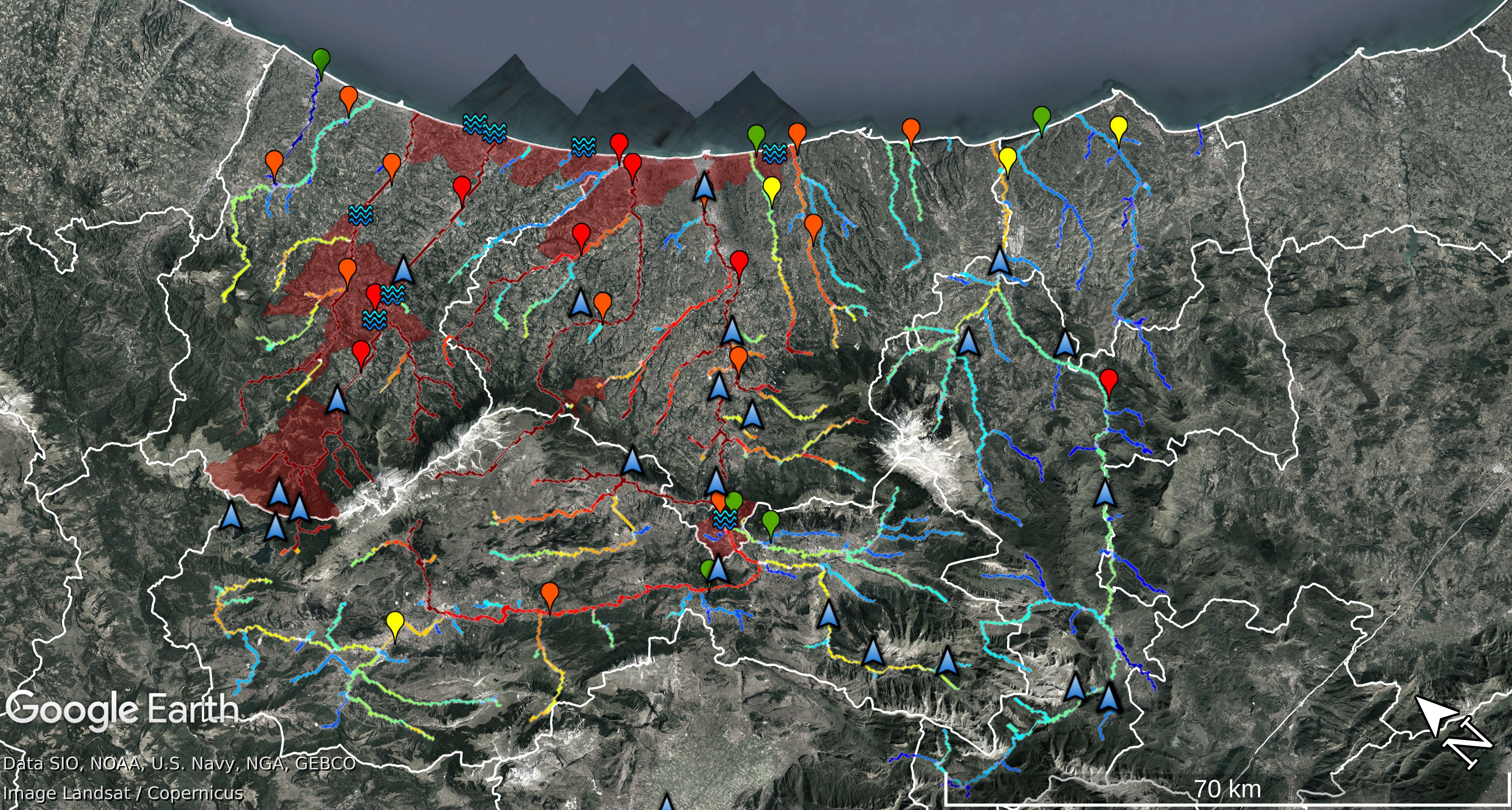
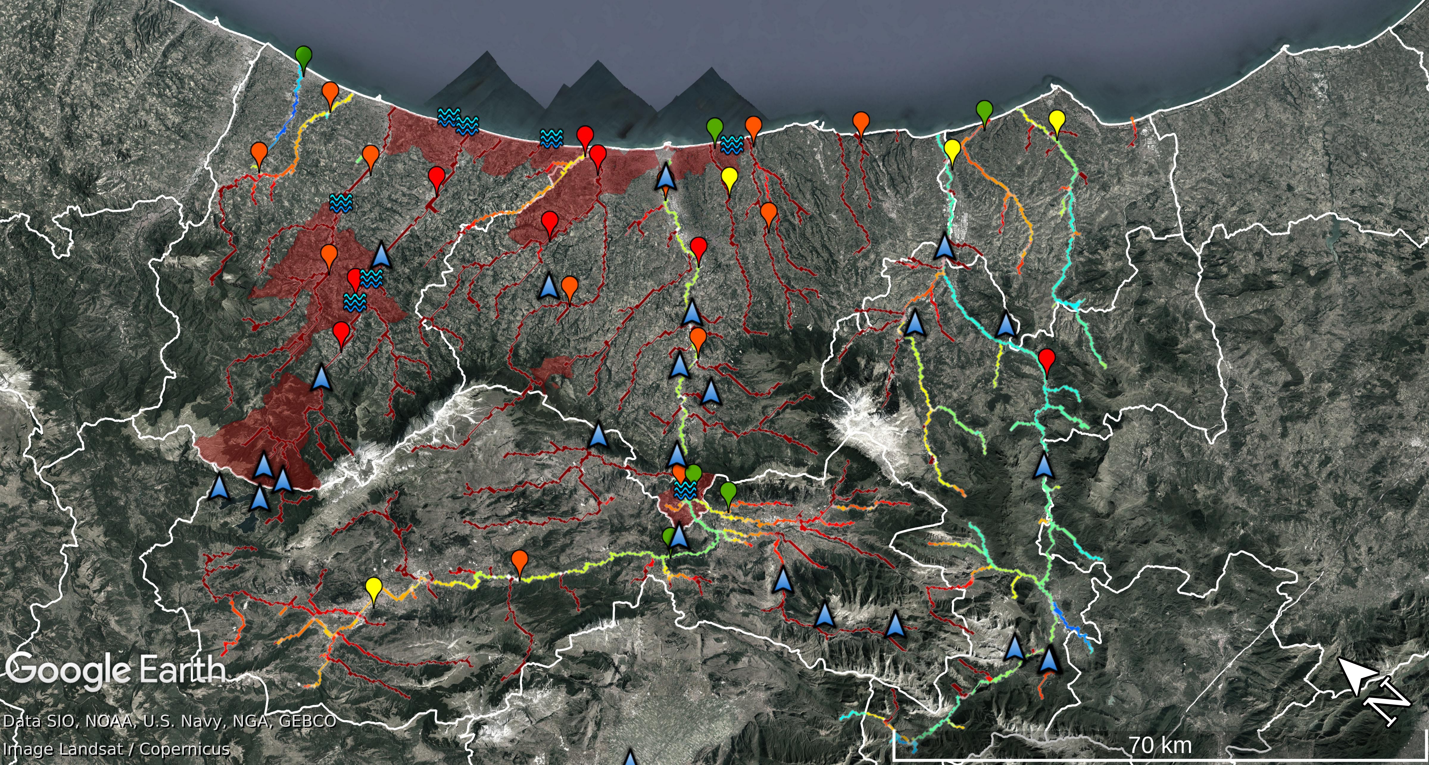
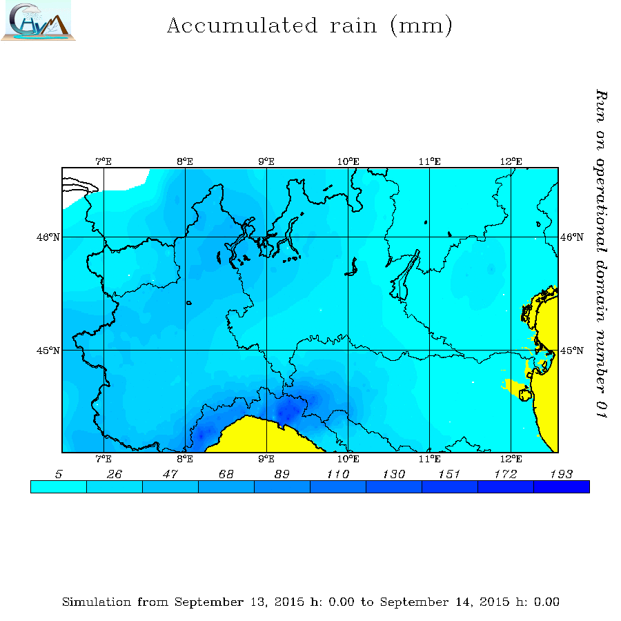
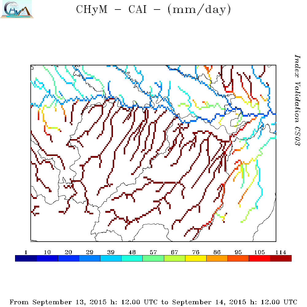
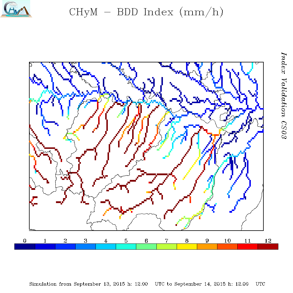
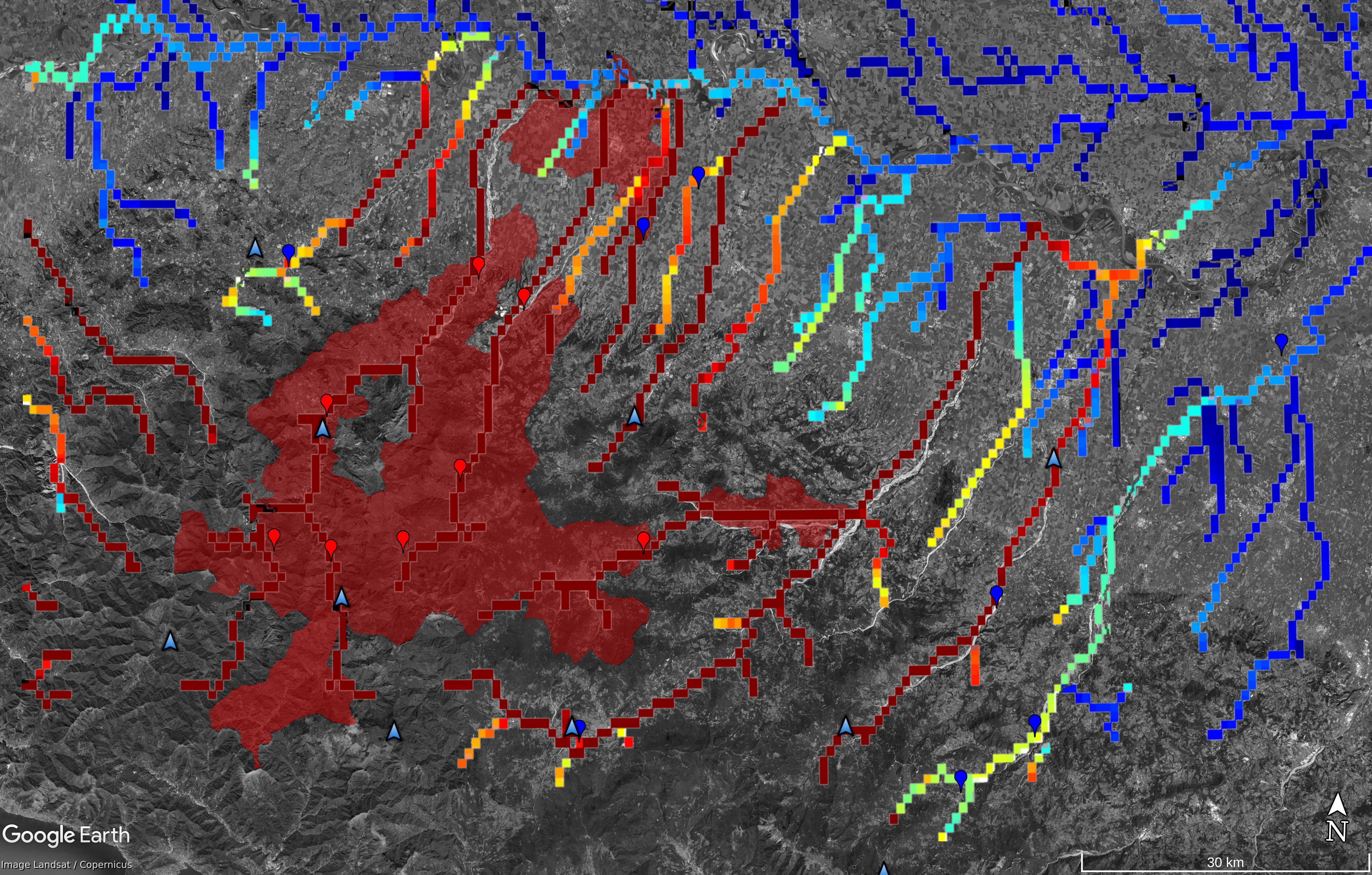
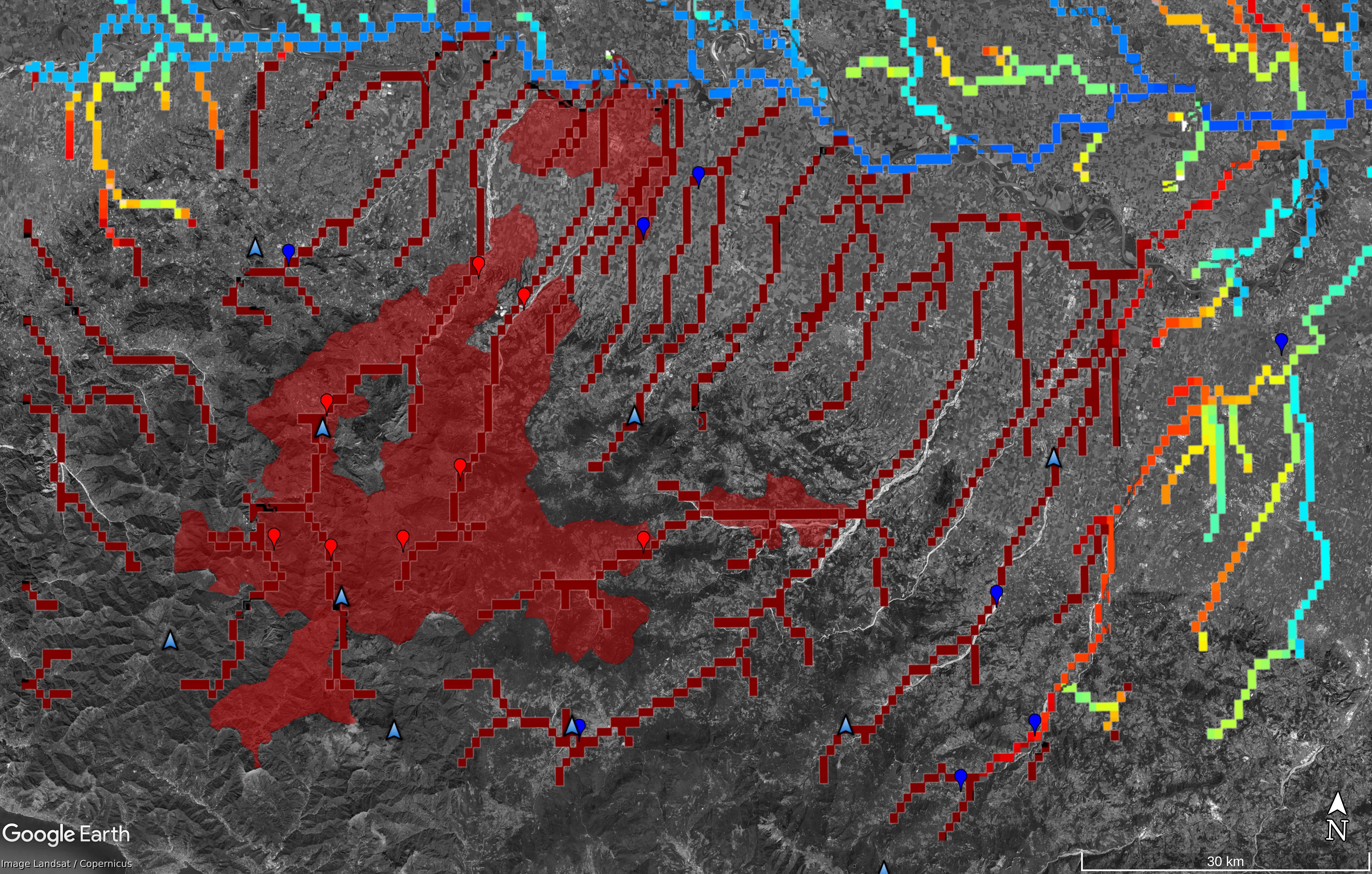
CS04 - Emilia Romagna Region - 14th September, 2015 - Nure and Trebbia River Floods
|
Heavy rainfall began to fall over the Liguria Region early on Sunday 13th September,
and then extended onto the Emilia Romagna Region on Monday. The intense rains immediately
caused severe floods and landslides in the province of Piacenza.
Hundreds people have been immediately evacuated from the areas alongside the two main rivers of Nure and Trebbia.
Two casualties have been reported and one person is missing.
|
|
| Case Study |
OBS
24h Cumulated
Rain Map |
CAI Map |
BDD Map |
BDD SOMMARIZED EVENT Map |
CAI SOMMARIZED EVENT Map |
| Nr |
04 |
| Area |
Emilia Romagna Region |
| Date |
14th September 2015 |
|
|
|
|
|
|
| Comparison prediction/observation and available documentation |
DOC0401
Case Study Analysis
DOC0402
CAI animation
DOC0403
BDD animation
DOC0404
CS04_EmiliaRomagna.kmz
DOC0405
COPERNICUS Emergency Management Service
DOC0406
ARPAE Report
DOC0407
Civil Protection Press Review 14th September 2015
DOC0408
Civil Protection Press Review 15th September 2015
DOC0409
POLARIS - IRPI - CNR
|
|
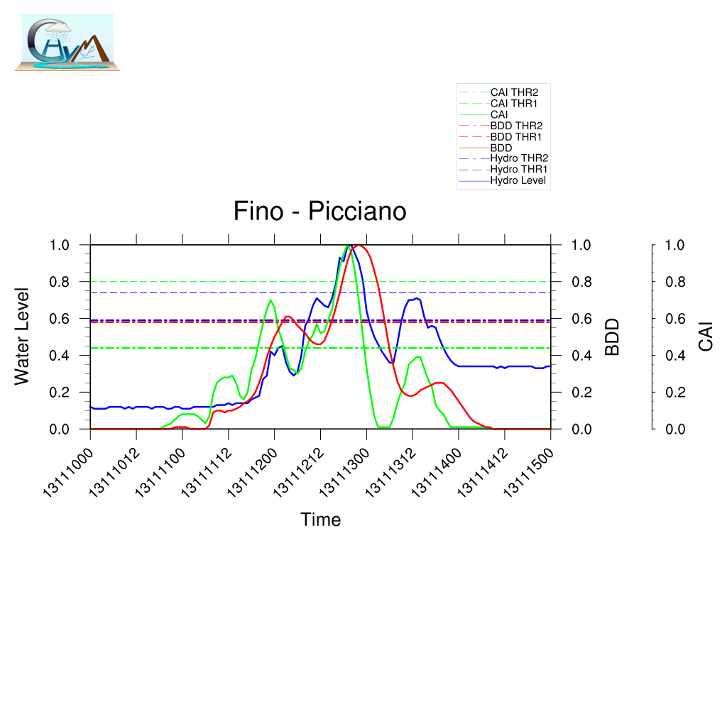
| Example of comparison between predicted/observed time series.
Here the complete analysis |
Summary of BDD performances |
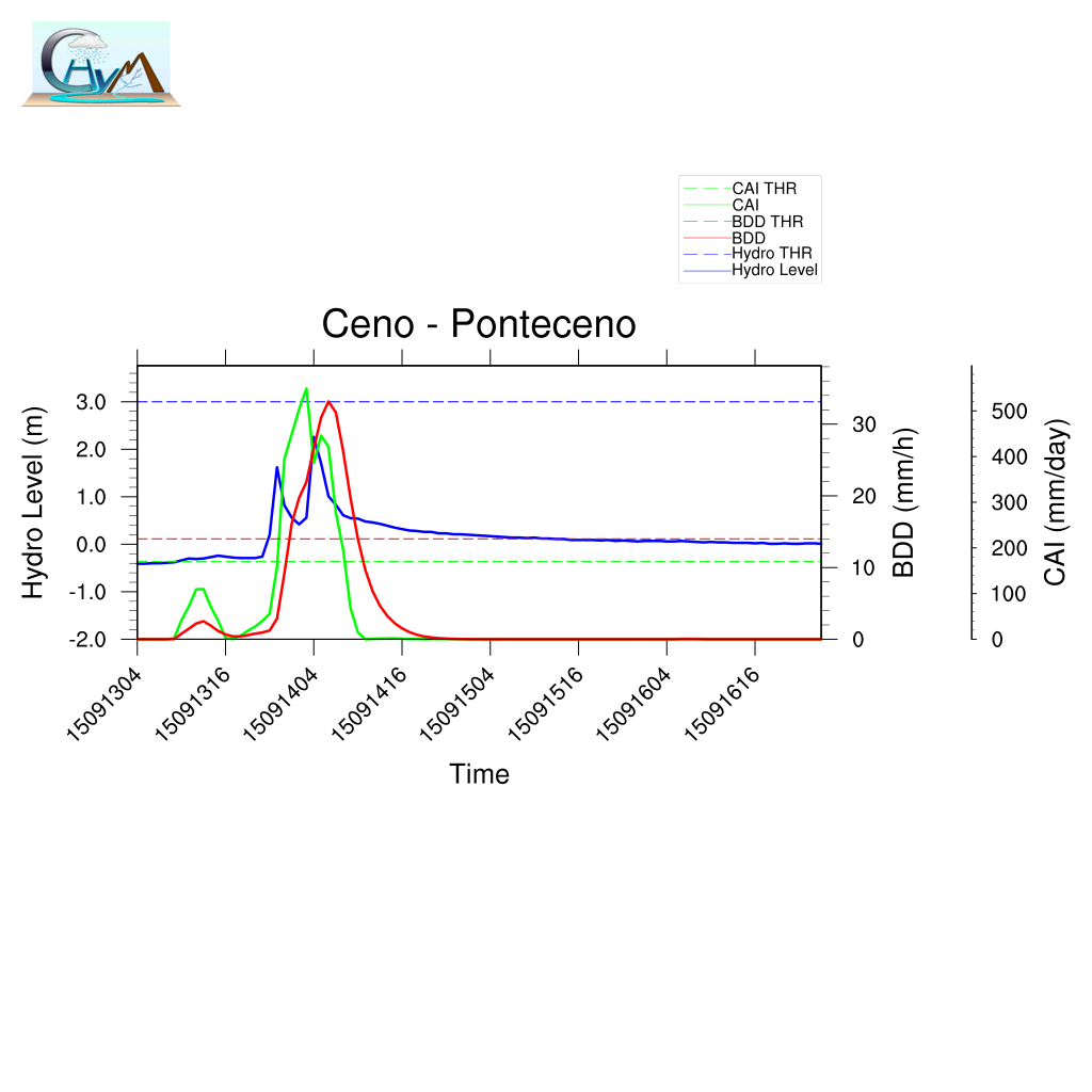
|
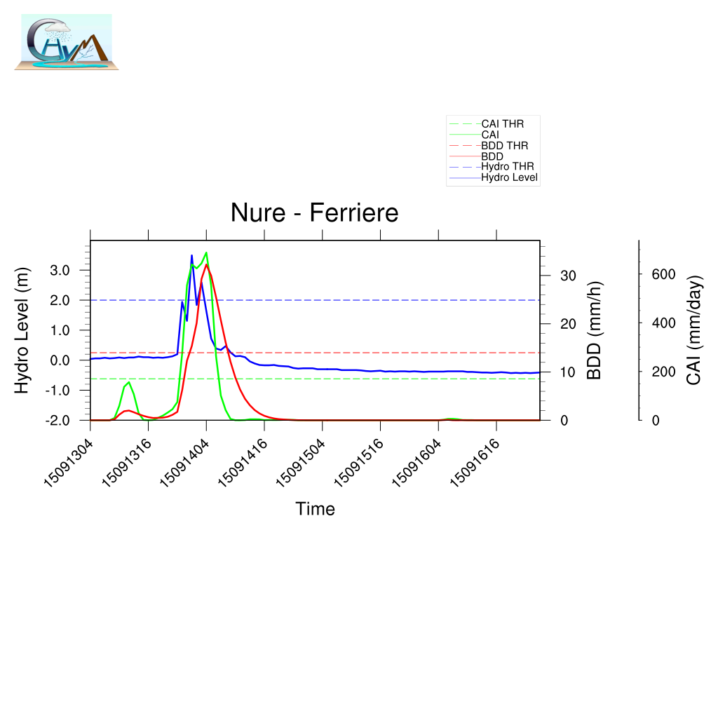
|
| Localization |
Timing |
| A | | LTP | |
| POD | | TPI | |
| FAR | | TMI | |
| | DDTV | |
|
|
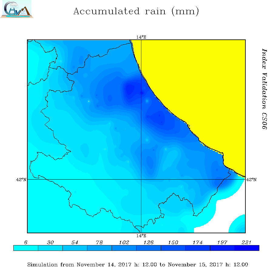
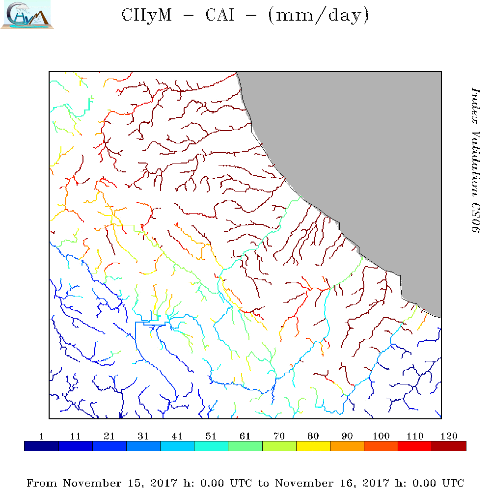
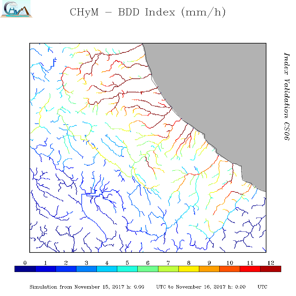
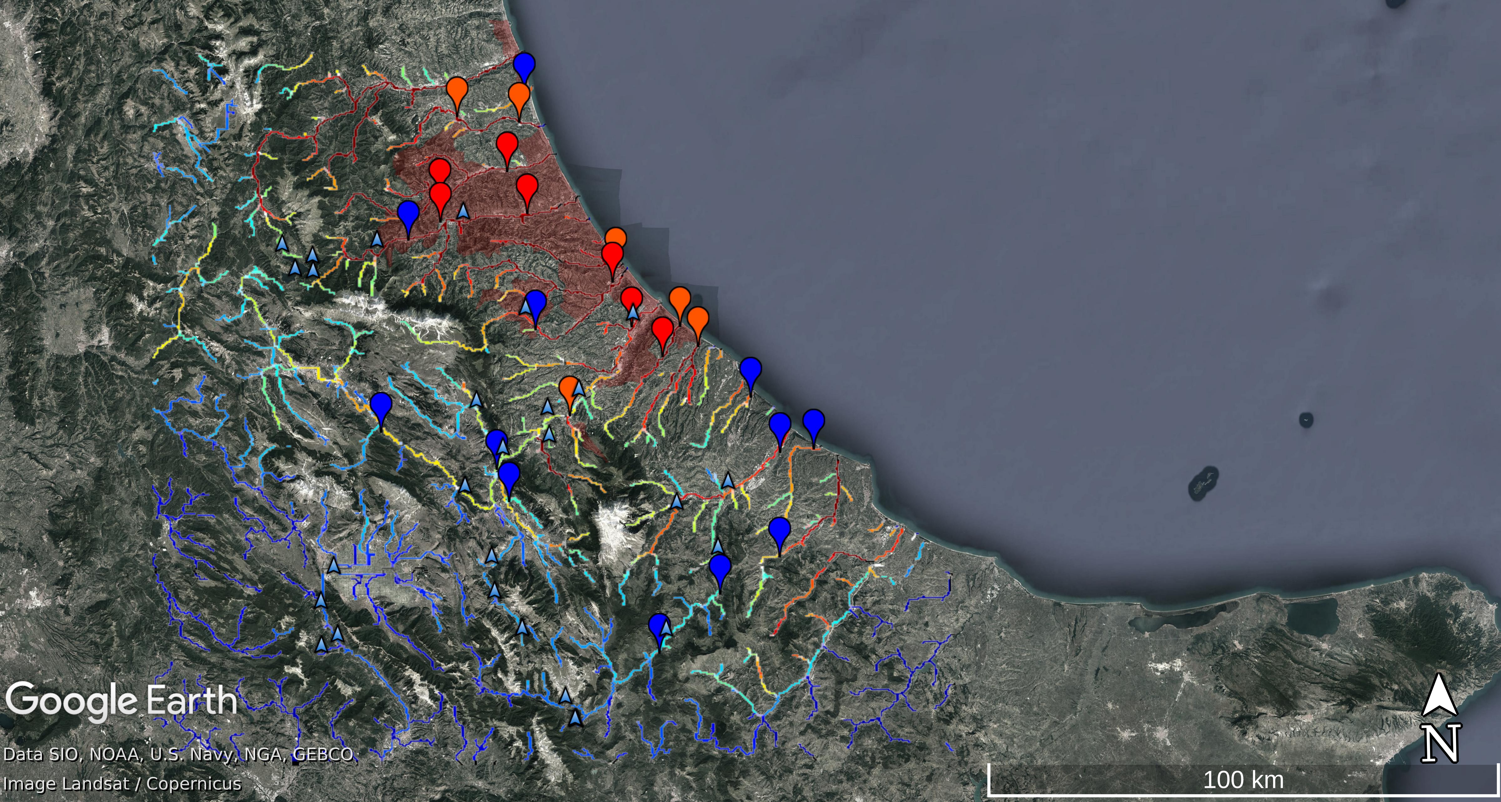
CS05 - Abruzzo 15th-16th November 2017 - Pescara, Vomano and Tordino Floods
|
Heavy rainfall began late on Sunday, 10th November and caused severe
floods and landslides across the North-Estern side of the
Abruzzo Region.
|
|
| Case Study |
OBS
Cumulated
Rain Map |
CAI Map |
BDD Map |
BDD SOMMARIZED EVENT Map |
CAI SOMMARIZED EVENT Map |
| Nr |
05 |
| Area |
Abruzzo Region |
| Date |
15th-16th November 2017 |
|
|
|
|
|
|
| Comparison prediction/observation and available documentation |
DOC0501
Case Study Analysis
DOC0502
CAI animation
DOC0503
BDD animation
DOC0504
CS04_abruzzo.kmz
DOC0505
Civil Protection Press Review 11st November 2017
DOC0506
Civil Protection Press Review 12nd November 2017
DOC0507
Civil Protection Press Review 13th November 2017
|
| Example of comparison between predicted/observed time series.
Here the complete analysis
|
Summary of BDD performances |
|
|
|
| Localization |
Timing |
| A | | LTP | |
| POD | | TPI | |
| FAR | | TMI | |
| | DDTV | |
|
|
|
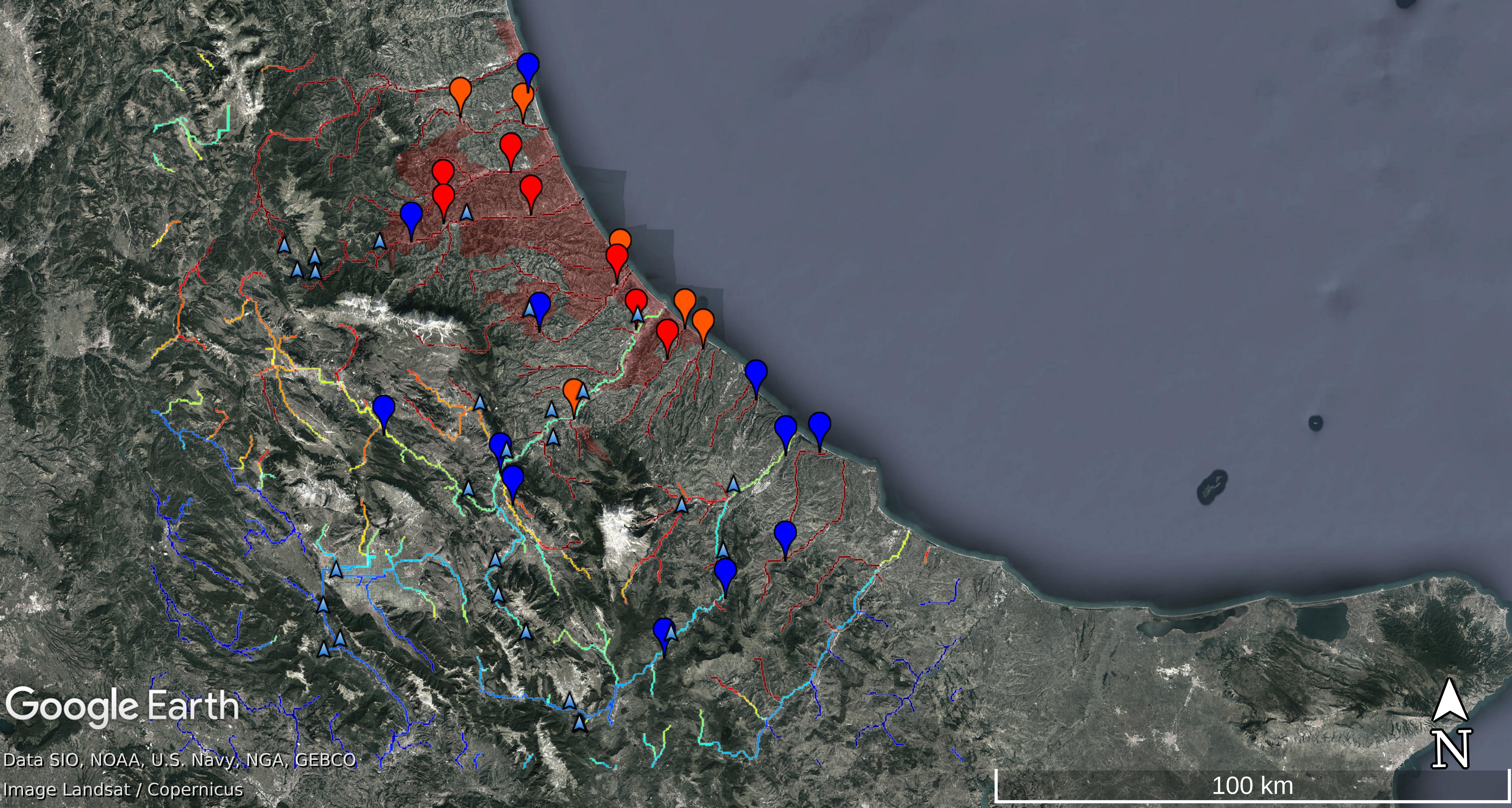
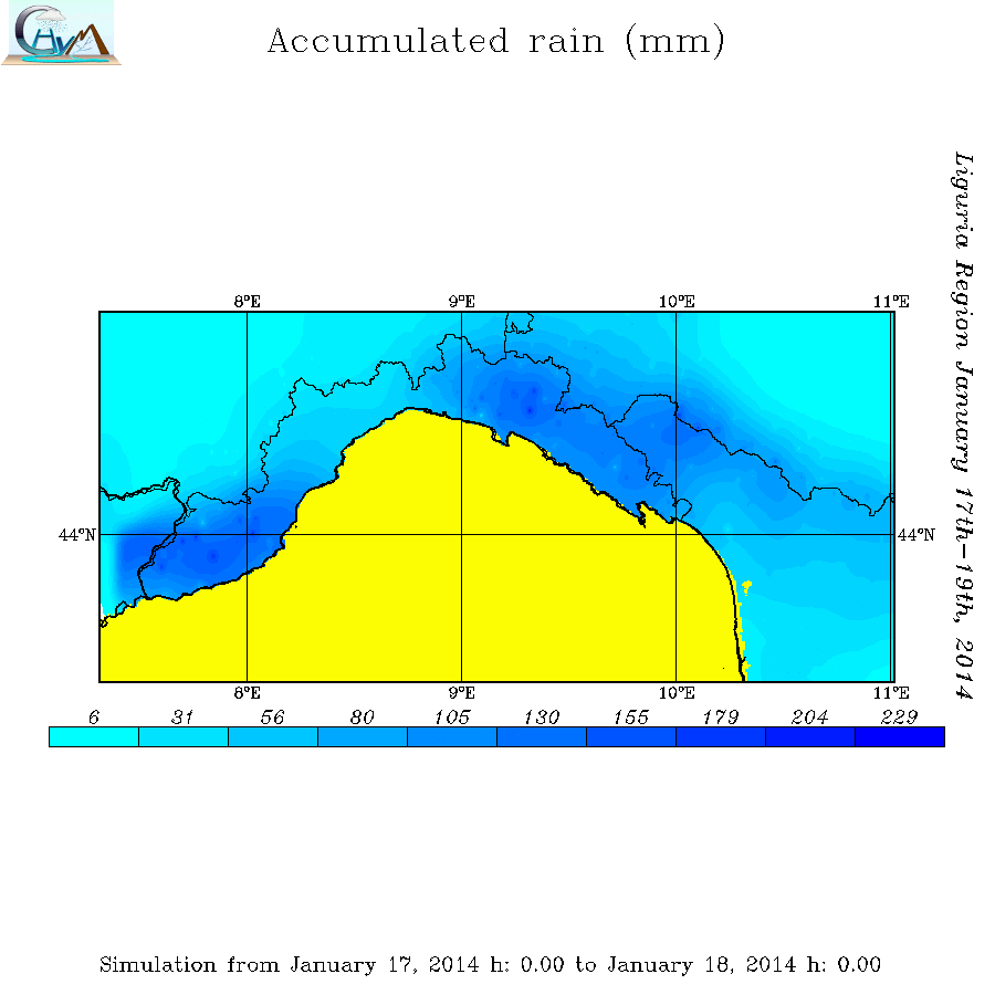
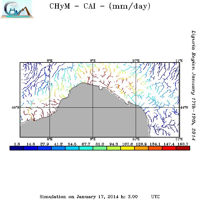
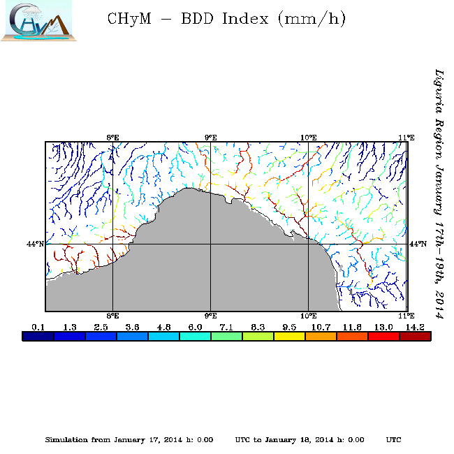
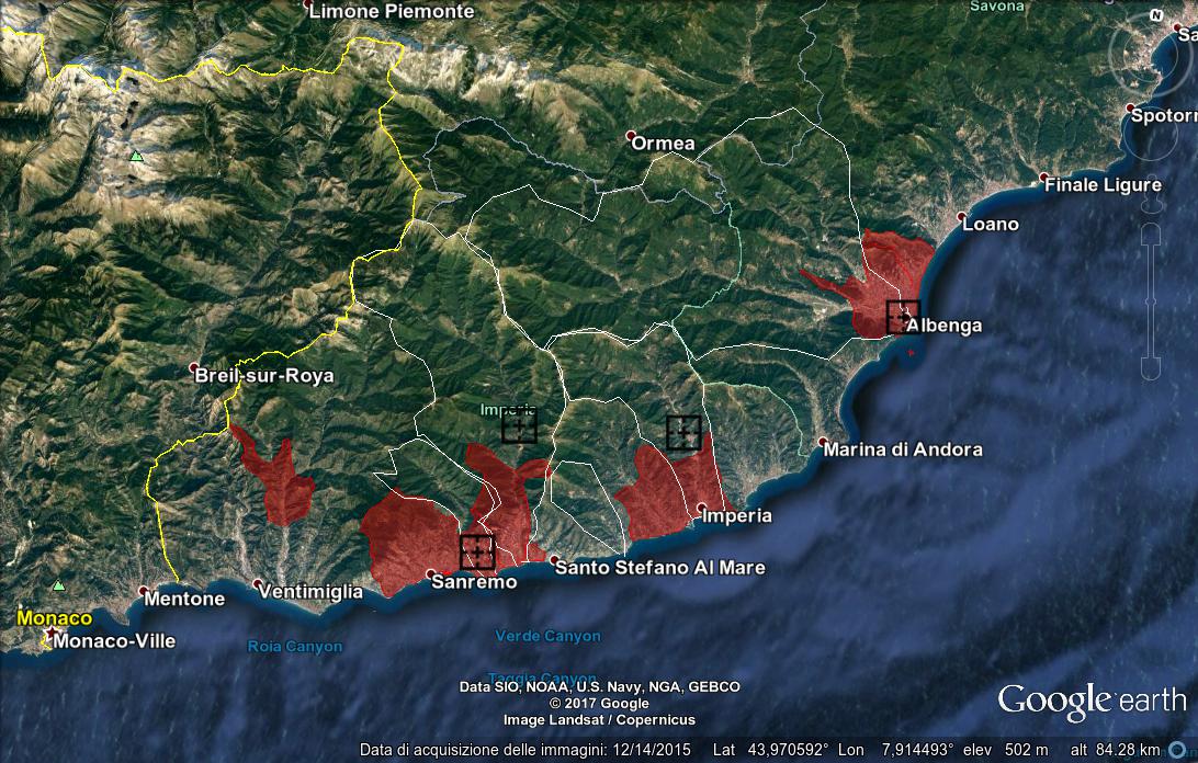
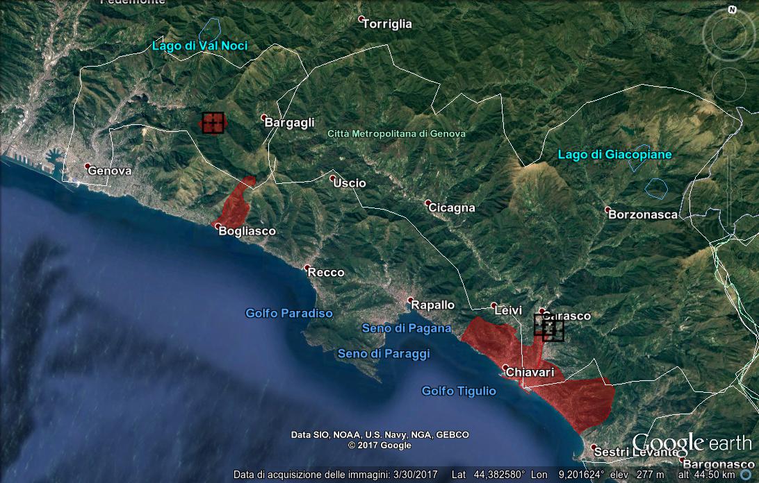
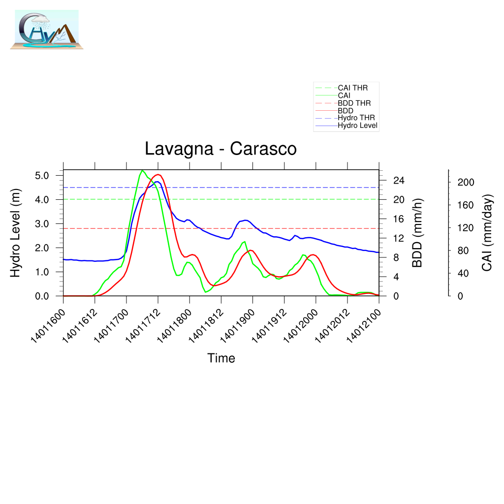
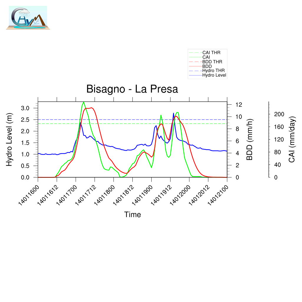
CS06 - Liguria Region - 17th-19th January, 2014
|
Heavy rainfall caused severe floods and landslides in the whole
territory of the Liguria region.
Quickly the event involved also the Emilia Romagna Region
causing an extended flooded area.
|
|
| Case Study |
OBS
24h Cumulated
Rain Map |
CAI Map |
BDD Map |
SOMMARIZED EVENT Map |
BDD+Hydrometric Station distibution Map |
| Nr |
06 |
| Area |
Liguria Region |
| Date |
January 17th-19th, 2014 |
|
|
|
|
|
|
|
|
| Example of comparison between predicted/observed time series.
Here the complete analysis
|
Summary of BDD performances |
|
|
| Localization |
Timing |
| A | | LTP | |
| POD | | TPI | |
| FAR | | TMI | |
| | DDTV | |
|
|
CS07 - Campania Region - 14th-15th October, 2015 - Volturno - Calore Basins
|
The heavy rainfall began early on Wendesday, 14th October
involving in particular the basin of Calore river in Campania Region.
The intense rains immediately caused severe floods and landslides
in the provinces of Benevento and Caserta.
A lot of people have been involved and several damages
occurred in particular to the transportation network.
In the next hours the flood wave of Volturno river is expected,
involving probably Capua village and the others villages
along the river.
|
|
| Case Study |
OBS
24h Cumulated
Rain Map |
CAI Map |
BDD Map |
SOMMARIZED EVENT Map |
BDD and Hydrometric Station distribution Map |
| Nr |
07 |
| Area |
Campania Region |
| Date |
14th-15th October, 2015 |
|

|

|

|

|
|
| Comparison prediction/observation and available documentation |
DOC0701
Case Study Analysis
DOC0702
CAI animation
DOC0703
BDD animation
DOC0704
CS07_Campania.kmz
DOC0705
COPERNICUS Emergency Management Service
-
DOC0706
EMSR141 - Activation Extent Map
-
DOC0707
Benevento Grading Map produced by EMS
-
DOC0708
Telese Grading Map produced by EMS
-
DOC0709
Castelvolturno Grading Map produced by EMS
DOC0710
POLARIS - IRPI - CNR
|
|
| Example of comparison between predicted/observed time series.
Here the complete analysis |
Summary of BDD performances |

|

|
| Localization |
Timing |
| A | | LTP | |
| POD | | TPI | |
| FAR | | TMI | |
| | DDTV | |
|
|

)
)
)
)
)
)
)
)
)
)
)
)
)
)
)
)
)
)
)
)
)
)
)
)
)
)
)
)
)
)
)
)
)
) DOC0102
DOC0102) DOC0103
DOC0103)
)
) DOC0202
DOC0202) DOC0203
DOC0203)
)
) DOC0302
DOC0302) DOC0303
DOC0303)
)
) DOC0402
DOC0402) DOC0403
DOC0403)
)
) DOC0502
DOC0502) DOC0503
DOC0503) DOC0602
DOC0602) DOC0603
DOC0603)
)
) DOC0702
DOC0702) DOC0703
DOC0703 DOC0706
 DOC0707
 DOC0708
 DOC0709
)
)